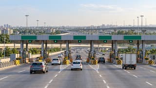
MoRTH’s urban decongestion policy requires future National Highway ring roads and bypasses taken up under the framework to be fully access-controlled, at least four lanes and equipped with closed tolling. For drivers, that points to a future toll design that may charge by distance travelled on new corridors—not an immediate change to existing FASTag charges or toll rates.
Key takeaways
- The policy was issued by the Ministry of Road Transport and Highways (MoRTH) on 29 May 2026 and was highlighted in a 21 Oct 2026 LiveMint report; it applies to urban decongestion projects on National Highways.
- Closed tolling is intended to link the charge to the section used, but the policy document does not publish a tariff, start date or route-wise fee.
- New corridors are planned for a design speed of 100–120 km/h, with interchanges at least 5 km apart and service roads for local traffic.
- States must participate in planning and financing; a 15-metre development-control zone is to be kept along each side, with a possible regulated zone up to 2 km.
What MoRTH’s policy changes
The primary document, titled De-congestion of National Highways in Urban Areas: Urban De-congestion Policy, was signed on 29 May 2026. It is not a nationwide order changing the price of every toll plaza or replacing FASTag today. Instead, it is a project-selection and design framework for ring roads, bypasses and similar National Highway interventions around urban areas.
MoRTH says congestion has grown because urban expansion brings local traffic, roadside development and long-distance freight onto the same highway. Its stated objective is to separate through movement from local movement, reduce travel delays, fuel consumption and logistics costs, and make new road investment last longer. For motorists, the practical test will be whether a new bypass offers a quicker, more predictable path even after the surrounding city grows.
How closed tolling could work
With an open or fixed toll, a road user normally pays at a particular plaza for using the facility. Under closed tolling, the entry and exit points are used to establish the section travelled. LiveMint’s 21 Oct report said the government’s plan would charge vehicles according to the distance travelled on these roads, while smaller city exits could potentially be exempted where traffic is low and tolling infrastructure is not justified.
That distinction matters, but the distance-based detail remains a reported implementation plan rather than a published tariff rule. Neither the MoRTH circular nor the report sets a single fee per kilometre, confirms a launch date for a specific corridor or says that every local exit will be tolled. A new road’s user fee would still need a project-level notification.
There is therefore no current toll increase to calculate from this policy. Existing FASTag balances, annual-pass terms and operational toll rates continue to be governed by their own notifications. For a journey today, drivers can use the toll-charge calculator to estimate the current route cost; future bypass calculations will depend on the final entry, exit and fee details.
What drivers, riders and fleets should expect
Through traffic gets a protected corridor
The policy requires new urban-decongestion projects to be fully access-controlled and at least four lanes wide. It sets a design-speed target of 100–120 km/h for passenger and freight traffic. That could reduce stop-start driving and unpredictable roadside interruptions on long trips, but it is a design objective, not a promise of a particular travel time or fuel saving.
For fleet operators, a more predictable corridor can help with arrival-time planning and fuel budgeting. The actual benefit will depend on the final alignment, congestion at interchanges, vehicle restrictions, toll charges and whether the connecting roads work as planned. A lower delay does not automatically mean a lower rupee cost if a route adds a distance-based toll.
When a corridor is announced, operators can compare the toll and fuel components together with the fuel cost calculator, rather than looking at the toll alone.
Local traffic must use planned connections
The circular says access should connect with National Highways, State Highways, approved city arterial roads and Major District Roads. It specifies interchanges at intervals of not less than 5 km; other public roads are to connect through slip roads. Service roads on the city-facing side are intended to carry local traffic without slowing vehicles on the main carriageway.
That means a bypass can improve through movement while making the choice of entry point more important for short local trips. The distance from a neighbourhood to an interchange, the availability of a service road and the final tolling layout will decide whether the new facility is convenient for everyday users. The policy does not provide a route map for individual cities.
Land-use controls are part of the plan
To prevent new ribbon development from recreating the same congestion, states are expected to notify a 15-metre green or prohibited development zone on either side of a new bypass or ring road, subject to the exceptions described in the policy for public transport and utilities. Beyond that, a regulated development zone can extend up to 2 km on either side.
The framework also requires state participation through options including land-acquisition cost sharing, land pooling, reimbursement of the state share of GST and royalties, or value-capture mechanisms. These provisions affect how projects are planned and funded; they do not by themselves announce a construction award, a land-acquisition date or a new toll charge.
How many cities are in view?
MoRTH’s assessment covered 83 cities with populations above 5 lakh. It identified 80 where highway speeds fell by more than 10% while passing through the urban area compared with sections outside the city. The policy says interventions were already addressing congestion in 32 cities, while planning was still needed for 48.
Those figures describe the policy’s prioritisation framework, not a promise that 48 corridors will open on a fixed schedule. Project alignment, state participation, land arrangements, appraisal and user-fee notifications will determine what moves forward and when.
What changes now—and what does not
- What changes: future urban-decongestion proposals on National Highways must be designed around access control, closed tolling, city master plans and long-term mobility planning.
- What does not: the circular does not change today’s toll rates, FASTag recharge process or current route availability.
- What to watch: state MoUs, alignment notifications, interchange and service-road plans, construction awards and the separate fee notification for each corridor.
For a planned journey, the road-trip planner can help compare route choices once a new bypass is open and its access points are known. If a future trip produces an unexpected FASTag debit, the FASTag toll-rules and complaints guide covers the checks to make before raising a dispute.
Sources
- Ministry of Road Transport and Highways, “De-congestion of National Highways in Urban Areas: Urban De-congestion Policy” — 29 May 2026
- LiveMint, “India to build access-controlled ring roads, bypasses to curb urban congestion” — 21 Oct 2026
- Business Standard, “Centre seeks state funding support for urban NH decongestion projects” — 2 Jun 2026